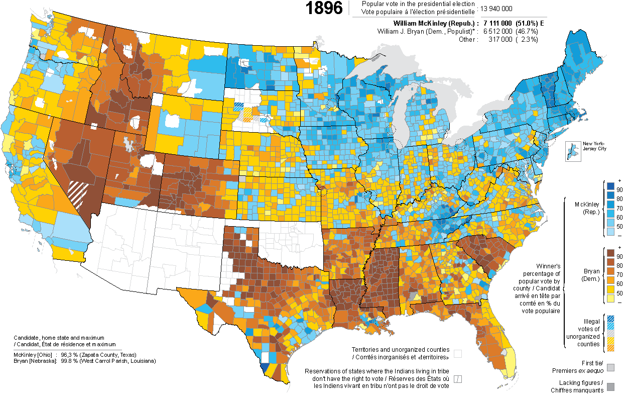
* Exceptionally, this map shows the cumulative results for two different presidential tickets: the Bryan-Sewall Democratic ticket, and the Bryan-Watson ticket, adopted by many populists.
Indeed, the electoral configuration varies from state to state (caused by many parties or factions here supporting these two lists, there supporting one of the two, elsewhere one of the two but by binding the electors to vote for the other if this one had a majority in the other states, etc.) and makes inoperative the distinction between Democratic and Populist vote.
SOUTH DAKOTA: some sources give results for the unorganized counties, even the least populous, results therefore illegal;
for their historical and political interest, they were mapped, without however being taken into account in the national totals.
In Virginia, for reasons of clarity and overall coherence, the Independent Cities are combined with the counties from which they arise.
See the french version (comment and notes in french but identical map)